

A piece of land may have endless possibilities. Without going and trying different options on the land and possibly failing, there is a way to see what limits there may be: soils.
Minnesota is home to a wide variety of soils and one acre could be very different to the one next to it. The reason for these differences is soil is made out of different properties. Texture, the particle size in the soil, is made up of sand, silt, and clay. Most soils are a different combination of these three. Structure is how the soil particles are arranged and indicates different land uses by how well the soil may hold water or be able to compact. Color of the soil can indicate water drainage or different mineral contents, which is useful when trying to determine if a certain vegetation is wanted on the site.
Luckily for us, there was a nationwide soil survey completed that maps out these differences. Back in the 1930’s after the Dust Bowl, the Soil Conservation Service (currently known as Natural Resources Conservation Service) began surveying the nation’s soils. In 1995, Rice County’s soil survey was updated and digitized making the maps more accessible and easier to integrate into land management software programs.
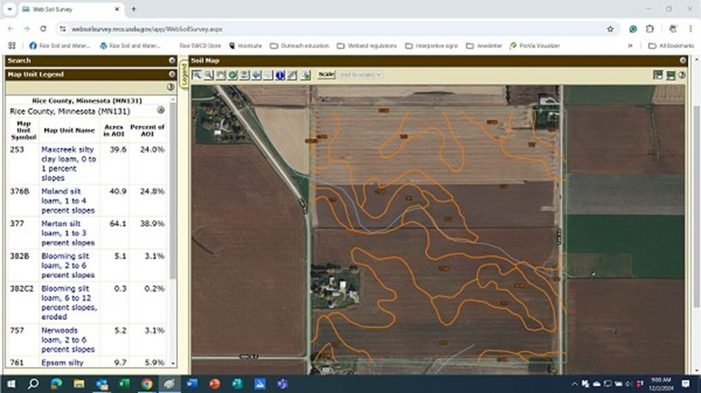
Today, soil survey information is available to everyone online through the use of the tool Web Soil Survey, https://websoilsurvey.nrcs.usda.gov/app/.
Once entering into the tool, anyone can draw boundaries for where they would like to look at the soils. After that, you can see the different soil types in that area under the soils map tab. The soil data explorer tab is where the more use-specific information can be found. Examples in our office are we use data in here to see how erosive the soil may be when designing erosion structures and how buildable the material may hold for these same structures.
There are a variety of ways different landowners may use this data. Farmers have access to crop productivity index for areas of their choosing, different water management for their fields, chemical properties for nutrient application, and many more. Other landowners can find out suitability for building different structures on the site, allowability for well and septic with the soil types, soil properties to help with landscaping, and more.
The tool then allows for easy printout with all the data selected. The printout will feature a map displaying the different property selected, along with a description for each rating.
One disclaimer is this data may be off slightly in boundaries. This data is just a good starting point and reference and on the ground is always best.
Staff in the local NRCS and SWCD offices have experience with this tool and are always happy to sit down and show landowners how to use web soil survey or do it with them in the office to get the data needed. Stop in our office or give us a call at 507-332-5408 to learn more about the soil survey of your land.
Emmie Scheffler is a District Technician with the Rice Soil & Water Conservation District and is the Plan Administrator for the Cannon River Comprehensive Watershed Management Plan. She also assists landowners and farmers with the implementation of soil erosion control practices and tree windbreaks. Contact Emmie with your questions at 507-332-5408.